

wildlife wildflowers and waterfalls
Monday, January 23, 2006
Destination Phoenix January 2006
Colorado and Grandchildren Friday and Saturday, January 13 and 14
We finally left home around 1:00 pm. We stopped by Chapman to visit Mom and still made it to Colorado by 9:15 pm. It helps that we gained an hour.
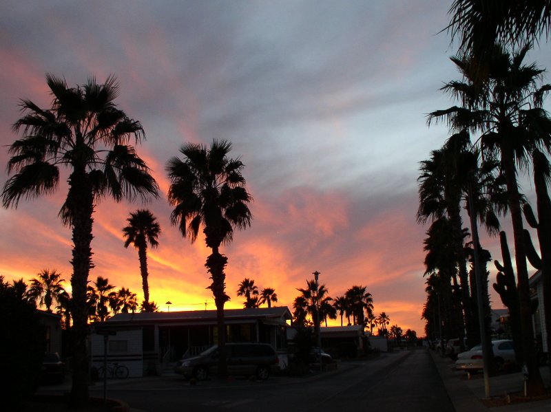
I often hear, read or see pictures of beautiful places at sunset. Last night we had a real treat. We traveled through western Kansas as the sun was going down. I felt like we were almost chasing it for a while. Grain elevators, church steeples and windmills stood out against the red sky on the flat skyline. I tried for a picture, but we didn't want to stop and couldn't get it on the run.
So, today we took Trent to his gymnastics class, watched the KSU Wildcats beat KU in basketball and enjoyed playing with the grandchildren. Drue's mother was visiting also so it was good to catch up with her.

Late in the afternoon we decided on a hike. The sun appeared just as it was setting behind the front range. We walked in to one of the unusual rocks located in the area. These rocks are probably the reason for the area being called Monument.
Tomorrow we are getting up early, hoping to reach Holbrook Arizona, while it is still daylight.
Santa Fe Trail and the City Sunday, January 15
%20of%20P1140002.2.jpg)
We left Colorado early Sunday morning. It was a good decision as I25 was free and clear through the Springs. The first stop we made was at the Ludlow Memorial Monument in southern Colorado. Over 25 men, women and children were killed in an early 1900s union strike involving the coal mining industry. It seems the coal companies commanded complete control over their employees. They shopped in a company store and their children attended company schools. This was their attempt at a strike, but it was a disaster. Eventually, the union was able to make their mark. Dan and I wondered if the song Sixteen Tons was the story of the coal mining industry before the labor movement.
As we entered New Mexico, the terrian became arrid, or at least it seemed that way from the road. Our next stop was a roadside rest stop. As it turned out, this was a very significant place. There was a monument signifing this as a stop on the Santa Fe Trail. There was a map showing the route of the trail and we were able to stand there in New Mexico, with the city of Santa Fe probably less than a week away by wagon on the trail and look on the map where that same journey had taken travelers within eleven miles of our home in Kansas. As we left the rest stop, we were sure we saw the ruts from the wagons in the soil.
%20of%20P1150016.2.jpg)
We decided we could not travel so close to the city of Santa Fe without stopping at least to eat. So, we exited off the interstate and headed toward the center of town. We parked in the visitor's center parking lot and headed down the street. The first restaurant was recommended by a passerby, but had a half hour wait. We progressed on down the street to the Upper Crust Pizza. They had a sign in the window boasting their vote as #1 pizza place in Santa Fe. Dan had Italian and I Greek Calzones. Delicious--#1 in our book.
We quickly visited the oldest church structure in the USA nearby. The original adobe walls and alter were built by Tlaxcalon Indians in 1610.
We had picked up a brochure about the wineries in New Mexico when we stopped by the visitor's bureau. Since we are not ones to pass up the opportunity to visit a winery, we picked two. The first was down a dusty back road. We were not sure it was even still in operation. As we entered the building we were pleasantly surprised. The winemaster was there ready to offer tastes and tell us about his wines. It was a very enjoyable stop and we purchased several of his varities. From there we visited a entirely different winery. The buildings were beautiful and their display of wines had ribbons and metals. However, their snobby young man barely gave us the time of day, charged us $2 to taste and we weren't impressed.
We then hightailed it into Arizona and made our destination of Holbrook by dark. We had to pass by the Petrified Forest National Park. However, we made the decision to travel the 12 miles back the next morning.
Petrified Forest and Phoenix Valley Monday, January 16
%20of%20P1150055.jpg)
%20of%20P1150052.jpg)
It was a good decision to go back the 15 miles to the Petrified Forest National Park although it had snowed the night before and we were unable to drive the more than 20 miles through the area. The visitor's center had very educational video, however, telling how the petrified wood was formed and the history of the National Park. It seems that millions of years ago the area was a forest with dinasours roaming freely. Then at some point there was a flood and the forest was washed to the present site and covered with silt. The silt slowly infiltrated the wood and turned to stone. The water dried up and the wood/stone was buried until the wind slowly exposed the petrified wood.
We realized that when they still hadn't opened the roads through the forest at 9:00, we better get going toward our destination for the day--Phoenix or more accurately Apache Junction. From Holbrook we entered the Apache National forest and the Mazatzal Mountains. At first we laughed that the small bush/trees that we saw on each side of the road sure was a different kind of forest. However, as we progressed further south, the trees were bigger and the mountains more beautiful. We did not realize that Arizona had so much forest and mountians. In realility, the "valley" as they say is the warm part of the state and the northern areas primarily along and north of I 40 are the highlands.
We arrived at Kayzie & Lynns around 2:00 pm.
Desert Botanical Garden Tuesday, January 17%20of%20P1170130.jpg)
Tuesday found us enjoying the warm weather and our friends hospitality. Kayzie and Lynn felt one place we must see is the Sonoran Desert Botanical Garden. It is a place where we could observe plants and animals found in the Phoenix area.
This was very interesting. We spent so much time there that the sun started to go down and that made it even more beautiful. The Sonoran Desert extends from central Arizona and southeastern California into Mexico. The Phoenix area is located in the northern part of the Sonaran Desert and is dominated by the Saguaro cacti, creosote bush and palo verde trees.%20of%20P1170090.jpg)
Of course my favorite is the Saguaro (sa-war-o) and it is the signature plant of the Sonoran Desert. It's waxy tough coating prevents water loss. Its shallow root system can quickly absorb a great deal of rainfall. They grow very slowly so a four foot tall cactus is probably at least 25 years old. If they are not killed by a frost persisting over 24 hours, struck by lightning, blown over by high wind or toppled by vandals, a saguaro can live to an age of 200 years.
There were other plants and animals that I will post later.%20of%20P1170095.jpg)
Superstition Mountain Wednesday January 18
“Located just east of Phoenix, Arizona is a rough, mountainous region where people sometimes go... only to never be seen again. It is a place of mystery, of legend and lore and it is called Superstition Mountain. According to history, both hidden and recorded, there exists a fantastic gold mine here like no other that has ever been seen. It has been dubbed the “Lost Dutchman Mine” over the years and thanks to its mysterious location, it has been the quest of many an adventurer... and a place of doom to luckless others.”
This quote is from the web site of Haunted Arizona (If you have time, it is an interesting read) Superstition Mountain is the hike we decided to take on Wednesday. We were not daunted by the thought of “doom to luckless others." Nevertheless, we brought our cell phones just in case.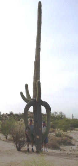 We started at the Jacob’s Crosscut trailhead. It was an easy climb at first, so we had to catch a picture of the unusual Saguaro cactus formation.
As we began to climb more seriously, I decided to step off the trail and briefly laid down my camera. My hand shows the result.
The landmarks on the mountain were becoming more visible and beautiful. I am disappointed in my fitness level as I was soon breathing hard.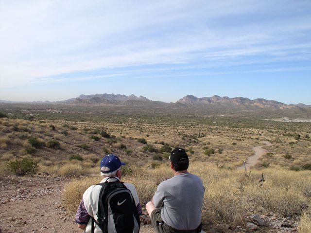
However, Lynn & Dan took pity (that’s the impression they gave, but privately I knew they welcomed the rest) and we sat on provided benches and enjoyed the fantastic view.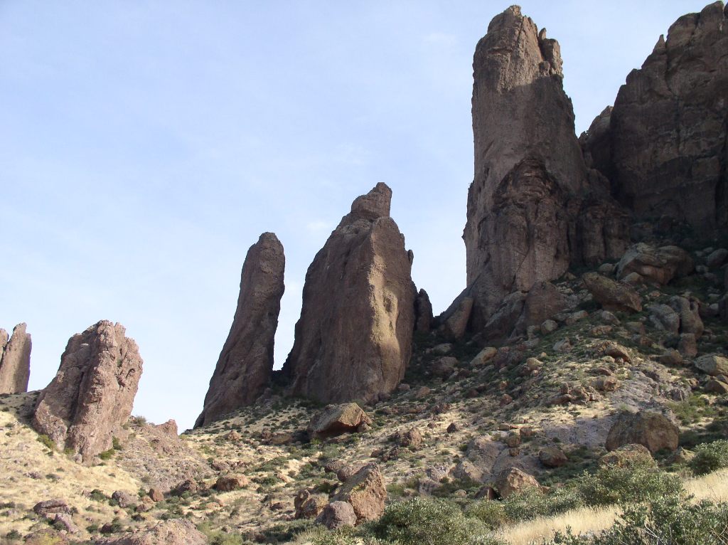
As it turned out, we were not on the trail that would eventually take us to the top of Superstition Mountain so we will try at it another year. This view was not far above us, however, and I wonder if it is the "needle" referred to in the story about the location of the mine.
It is always fun to get out and experience the terrian first hand....
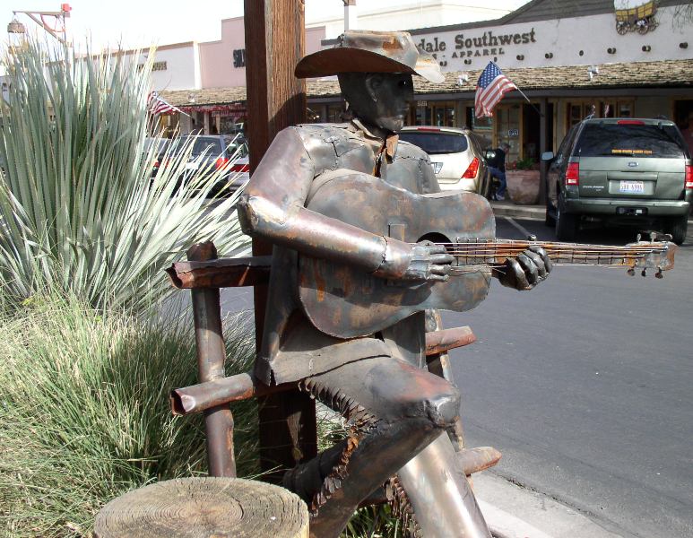
Scottsdale and Oranges Thursday, January 19
Kayzie and I decided a little shopping would be in order and the guys thought they would make the best of it. As it turned out it was a interesting day.
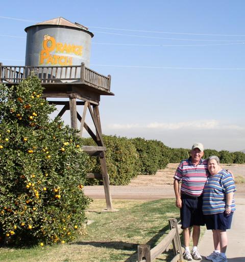 First stop was the Orange Patch. It is exactly what the name implies in that it is a working grove with a store to sell not only their delicious oranges but lots of other tempting ware. We tasted all the varities they had available and decided on the tree rippened Navel. We also bought honey butter for gifts as well as Wickles (a wickedly delicious pickle--I think they are hot) for my friends at the post office.
 Next we headed to Scottsdale--a very familiar name to golfers. However, I did not realize it is a shoppers paradise and has beautiful streets. We looked in a couple shops and marveled at the artwork--mostly Native American. I have a birthday in a couple of weeks and Dan bought my present early--anyone who knows me would guess what it is--a purse, of course.
Then we headed to the Scottsdale Museum. The lady in charge suggested we head over to the square to watch the dancers. We took her advice.

The music was beautiful. There were representatives from at least five tribes in the group. At the end of their concert we were all invited to form a big friendship circle while they played music and danced in the middle.
From there we headed back to the museum and learned how water was trenched into the area--the one important element in the settlement of the desert.
We ended the afternoon with window shopping and admiring the art at each street corner.
This best describes our visit with our long-time special friends.
On the road again January 20
We enjoyed our visit with Kay and Lynn, but all things must come to an end as three days is our limit to impose on family or friends. So, we were up at 6:00 am eating their delicious steel cut oats made in the crock pot and served with brown sugar, raisins, English walnuts and a little milk. We left around 7:00 and as it turned out, a perfect time.
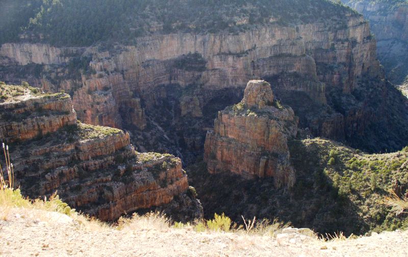 The route Lynn suggested out of the valley was east to Globe and then northeast on Hwy 60 through Salt River Canyon. The canyon was beautiful in the morning light. We did not make good time through the mountains as we kept pulling over to enjoy the views.
It was around 11:30 am when we arrived in Holbrook and I40. We needed to drive across New Mexico as Tucumcari was our destination. So, it was pedal to the metal as they say the rest of the day with only rest stops. We reached Albuquerque at 5:00 and wouldn't you know I was driving. I gripped the wheel, watched the vehicle in front, stayed with the traffic and Dan read signs. We zoomed right through.
Earlier in the day I noticed Ute Lake State Park at Logan, New Mexico. Since we had planned to head northeast on Hwy 54, we decided to bypass Tucumcari for the night stay and heard to Logan. Again, a good decision primarily because they had a little Mom and Pop diner that served delicious suppers and breakfasts.
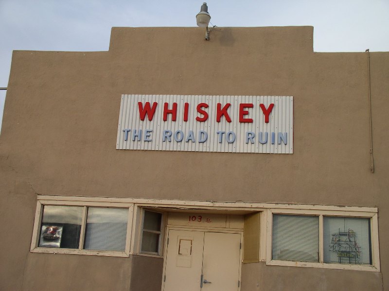
This was not the diner, but the local watering hole. Hmmm, can't say they didn't warn their customers.
Kansas and Home January 21 and 22
We always feel good when we cross the State line. We planned on staying the night with our Salina family, so we decided continue our exploration of the Santa Fe Trail route as well as southwest Kansas, but not before visiting--briefly--Oklahoma and Texas. We followed Hwy 56 up from Texas through the Cimarron National Grassland. The 108,175 acres is the only land managed by the Forest Service in Kansas. It was created after the Dust Bowl of the 1930s in an effort to reconstruct the land.
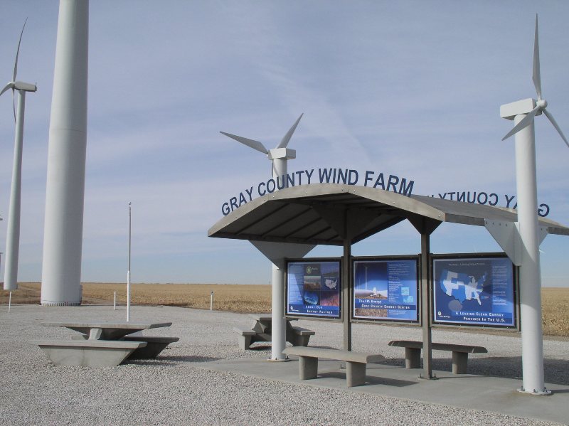
At Montezuma is Kansas' first wind farm. It is impressive. Here are some facts we learned at the informational site. The blade length is 77 feet and each tower is 30 stories to the top of the blade. Wind energy facilities generate power at 5 cents per kilowatt hour. The Montezuma site is 12,000 acres and produces enough energy for 33,000 homes. Wind farms have not been met with a great deal of enthusiasm by land owners especially in the Flint Hills, however Kansas does rank 3rd in wind energy potential.
Our next stop was Dodge City for lunch. Boot Hill was closed so we ate fast food and moved on. How do you know you are in Dodge City? There is Wyatt Earp Liquor, Wyatt Earp Inn, Doc Holiday Liquor, Miss Kitty Boutique, Boot Hill 66 and Hitch' Post Travel Plaza. I even thought I saw Shoots Haircutting.
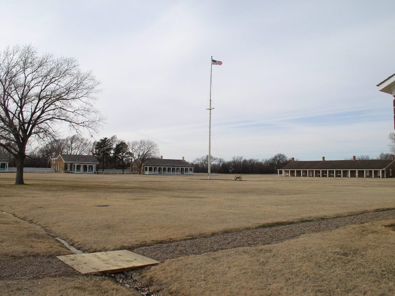
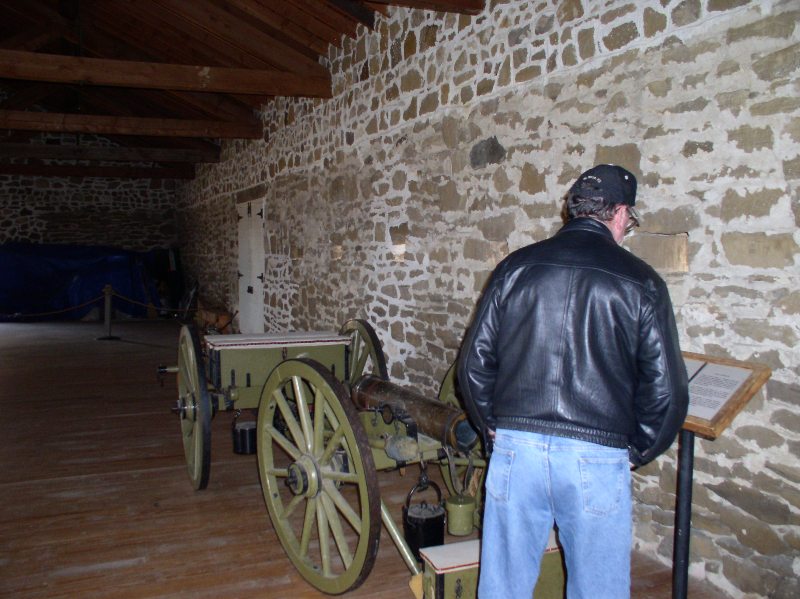
At Kinsley Hwy 56 meets the Santa Fe Trail. Near Larned is Fort Larned, a National historical site. This is well worth a stop. The Fort has been almost completely restored complete with furnishings, clothes and guns. Pete Bethke was the Park Service Ranger in charge when we were there. Perhaps it was because we were the only visitors at the time, but he took the time to answer all of our questions in detail. Almost all the buildings were open.
 Fort Larned was built as a guardian of the Santa Fe trail in 1860. The trail carried several million dollars in commercial traffic between Independence Mo. and Santa Fe NM. With the acquision of land after the Mexican War and the gold rushes the trail became even more popular. Soon the great influx of travelers began to disrupt the Indians way of life so skirmishes and full scale attacks began. Fort Larned was built to protect travelers along the Trail. Mr. Bethke told us that actually it was cheaper for the infantry to walk with the travelers rather than the cavalry on horses.
 The need for the fort decreased after the railroad progression in the 1870s and in 1884 it was sold at public auction. For the next 80 years it was a working farm, with the family living in the General's headquarters. In 1964 Fort Larned became a national historical site. Most of the buildings have been kept intact with the exception of the Blockhouse which was rebuilt exactly as it was originally. We are looking forward to taking our grandchildren to visit during one of the Park's summer programs. Mr. Bethke told us the children are allowed to sit on the bunkbeds and try on the soldiers clothing. Again, it is one of only five Kansas National historical sites (Nicodemus, Brown v. Board of Education, Fort Scott and Tallgrass Prairie).
From Fort Larned we traveled just a few miles more to stop at the Santa Fe Trail museum. We stayed so long at the fort that we only had a short time at the museum before it closed. The one fact I learned there was that merchants traveled on the Santa Fe Trail north from Mexico as well as south from Independence. The museum had many exhibits of period clothing, wagons, dishes, etc. It is well done and worth the small admission charge.
We briefly stopped by Pawnee Rock, a once high outcropping of rock on the prairie that could be seen for miles. At the top of the rock, the flag at Fort Larned could be seen.

It was dark when we arrived to a joyous welcome at Salina. We played games with the boys, our kids, ate some welcome homecooked food and went to bed. Sunday would be a stop by Chapman to visit Mom and home.
Travel Links

Kansas Flint Hills Travel
Trips
Wild Card Wine Trail Hermann Missouri May, 2012
St Patrick's Day, Weston Missouri March 2012
Alaska, 2011
Texas Hill Country Blue Bonnets 2011
Colorado - Hwy I-25 to Durango, Hwy 550 (Million Dollar Hwy) to Black Canyon of the Gunnison National Park - August. 2010
Butterfly Pavilion, Denver CO April 2010
Colorado, Phoenix AZ, and Palestine Lake near Tyler TX March 2010
Indiana Christmas Roadtrip December 2009
Symphony in the Flint Hills 2009
Missouri Chocolate Wine Trail February 2009
Oktoberfest Hermann Missouri, October 2008
Black Hills-Buffalo Roundup-Devils Tower Sept 2008
Cache La Poudre River, Routt National Forest and Colorado State Forest July 2008
Symphony in the Flint Hills 2008
Breckenridge Family Ski Vacation January 2008
Iowa and South Along the Mississippi River November 2007
Cherokee Land Rush October 2007
Missouri Wine Trail October 2007
The Great American Cattle Drive Ellsworth KS Sept. 2007
Overbrook Fair August, 2007
The Woodward Topeka KS July 2007
Symphony in the Flint Hills 2007
St. Louis April 2007
Cottonwood Falls Scenic Byway December 2006
Acadia National Park and New England States Fall 2006
Destination Phoenix January 2006
Kansas: Home along Hwy 56 January 2006
Canadian Fishing Trip August 2005
Missouri Trees and Wine October 2005
Kansas: Goodland to Home Hwy 36 July 2005
Breckenridge--Family Vacation July 2005
Flint Hills Barn Tour October 2004
![]()